TIME
3h. 15 min.
TRAIL TYPE
Walking
DIFFICULTY
Medium
DISTANCE
11232 metres
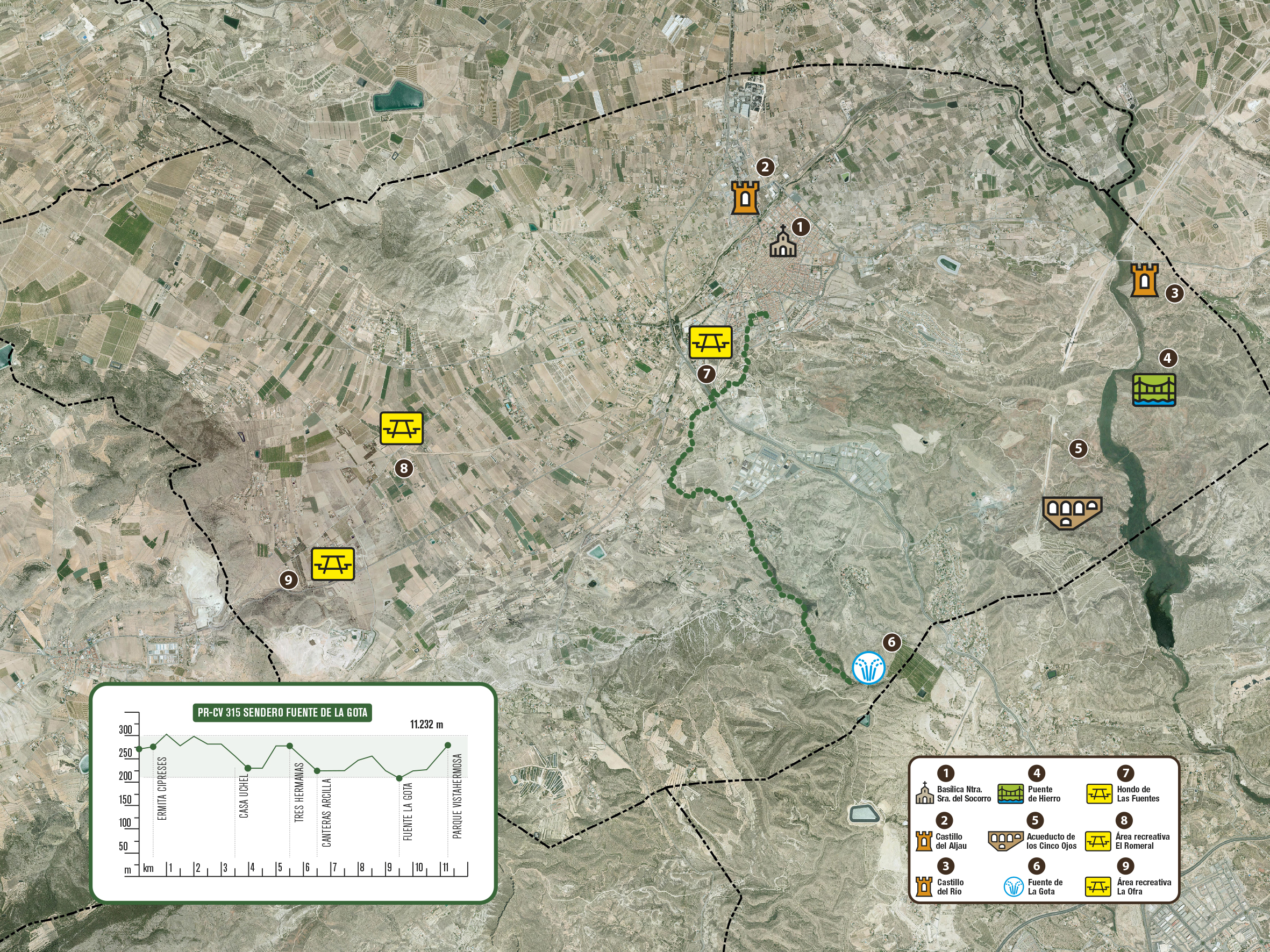
Our trail begins at Vistahermosa park. From this point, we shall head towards Ermita los Cipreses hermitage, before heading along the main track to Cantal de Eraes forest area. We then take a detour to the right and continue along Calera track descending towards CV-84 (Aspe-Elche) road. Please before cross the road carefully to reach the CV-84 pipe shaped underpass located in a dip. Once we have reached the other side of the road, we shall take the Balsita Don Blas track and continue along a straight line route that opens on our left to reach Lomas del Muladar hills. We shall then march along a forest trail for about 700m before continuing along Cherro track.
Gradually, the landscape that was initially dominated by rural buildings and crop fields becomes clearer as we advance towards Altos de Pepe Rusa. This spot will become visible straight ahead as we get closer to Tres Hermanas II Industrial Estate where we connect with Uchel road on the right.
We shall leave the tarmac section of Uchel road opposite a curve in order to head along a dense, encased reedbed that will reveal the first sections of Barranco de las Monjas ravine. We shall march through a dense cane and reed copse that makes the route extremely difficult at times, although the trail shall remain perfectly visible along the right bank of the ravine due to being so frequented by the local excursions.
Fuente de la Gota fountain is embedded into one of the ravine’s cavities on Sierra del Azafa mountains marking the layout of two rock layers. Situated on the top layer, the fountain comprises a thin but constant trickle of spring water, hence its name (literally, the droplet fountain). This natural site is noted for its vast beauty and good preservation status.


